
File:Yall US Map.svg

Original file (SVG file, nominally 959 × 593 pixels, file size: 237 KB)
| This is a file from the Wikimedia Commons. Information from its description page there is shown below. Commons is a freely licensed media file repository. You can help. |
| Description |
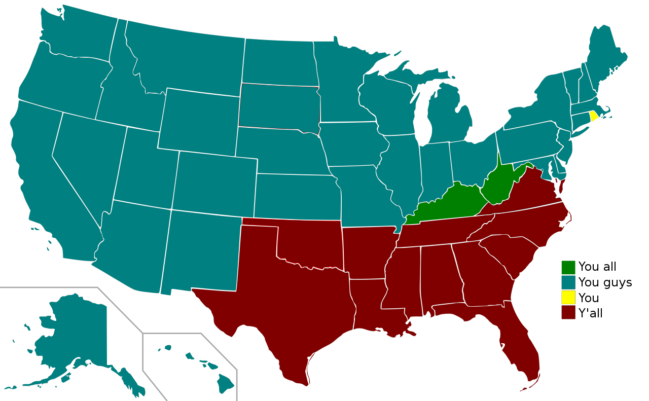
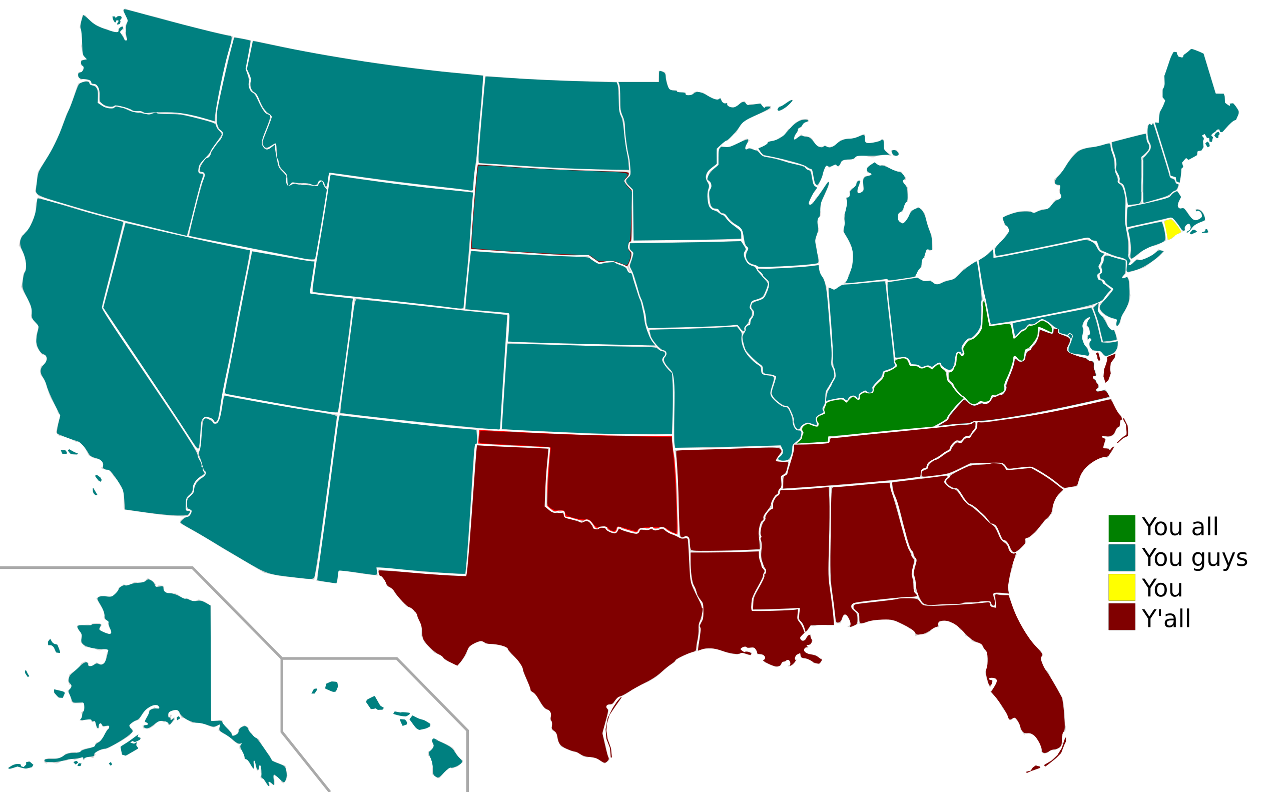
A map of the United States indicating regional variation in the word(s) one uses to address a group of two or more people.. Edited in Inkscape. Data drawn from "Dialect Survey." http://www4.uwm.edu/FLL/linguistics/dialect/staticmaps/q_50.html |
| Date | (UTC) |
| Source | |
| Author | |
| Other versions |
Derivative works of this file: 2008, Swing States.svg
Labelled US map.svg This map with state labels |
| This is a retouched picture, which means that it has been digitally altered from its original version. The original can be viewed here: Blank US Map.svg:
|

|
Permission is granted to copy, distribute and/or modify this document under the terms of the GNU Free Documentation License, Version 1.2 or any later version published by the Free Software Foundation; with no Invariant Sections, no Front-Cover Texts, and no Back-Cover Texts. A copy of the license is included in the section entitled GNU Free Documentation License. |
| This file is licensed under the Creative Commons Attribution-Share Alike 3.0 Unported license. | ||
| ||
| This licensing tag was added to this file as part of the GFDL licensing update. |
Original upload log
This image is a derivative work of the following images:
- File:Blank_US_Map.svg licensed with GFDL
- 2008-10-09T16:36:40Z Howcheng 959x593 (80121 Bytes) Reverted to version as of 08:32, 14 June 2007
- 2008-03-12T00:20:02Z AMK1211 959x593 (174744 Bytes) Added borders: Light blue for water borders and black for land borders (international borders thicker).
- 2007-06-14T08:32:47Z Fibonacci 959x593 (80121 Bytes) Optimised code.
- 2006-07-12T23:00:30Z Theshibboleth 959x593 (90537 Bytes) The line framework around Alaska and Hawaii has been pushed a bit
- 2006-07-12T06:35:19Z Theshibboleth 959x593 (89828 Bytes) added DC
- 2006-07-12T06:05:05Z Theshibboleth 959x593 (89649 Bytes) {{Information |Description=A blank map of the United States in scalable vector form. |Source=Own work, based on [[:Image:Electorial map.svg]], inspired by [[:Image:BlankMap-World.png]] |Date=11 July 2006 |Author=[[User:Theshi
Uploaded with derivativeFX
File history
Click on a date/time to view the file as it appeared at that time.
| Date/Time | Thumbnail | Dimensions | User | Comment | |
|---|---|---|---|---|---|
| current | 21:33, 27 May 2009 | | 959 × 593 (237 KB) | Clark3934 | {{Information |Description=A map of the United States indicating regional variation in the word(s) one uses to address a group of two or more people.. Edited in Inkscape. Data drawn from "Dialect Survey." http://hcs.harvard.edu/~golder/dialect/ |Source=*[ |