The Western U.S. is getting higher and drier. And I'm not talking about the recent legalization of marijuana in Colorado and Washington. A new study published today (Aug. 21) in the journal Science found that the severe drought that has gripped the West since 2013 has actually caused much of the land mass in that part of the world to rise, by an average of 0.16 inches (4 millimeters). That may not sound like a lot, but it is when you consider the sheer extent of terrain that is the West.
In some places, it's even worse. In several mountainous areas in California, for example, the land has risen by 0.6 inches (15 mm) since the beginning of the drought.
On a grand scale, the water found in rivers and lakes, and underground in aquifers and subterranean reservoirs, acts like ballast for the Earth, weighing it down. When water is removed by humans or naturally evaporates—and isn't replaced by rain or snowmelt—the land suddenly has a weight off its shoulders, so to speak. So it "rebounds," or lifts up, said study co-author Adrian Borsa, a researcher at Scripps Institution of Oceanography, at the University of California San Diego.
The same thing happens when glaciers melt, a phenomenon called post-glacial rebound.
The rising West is more than just an interesting finding. By measuring how much the land has risen, researchers from Scripps and the U.S. Geological Survey have come up with a more detailed estimate of the the West's water deficit—that is, how much less agua there is, compared to average. By their calculations, it's 240 gigatons, or 64 trillion gallons, equivalent to a four inch (10 cm) layer of water covering the entire western U.S.
"We can't really tell you how it compares to previous big droughts," because today's technology didn't exist; but suffice it to say that "it's huge," Borsa said of the water deficit.
The researchers said that their approach helps augment another high-tech method for measuring levels of surface water, carried about by NASA's Gravity Recovery and Climate Experiment. GRACE, as it's called, uses a pair of satellites to find minute gravity fluctuations on the surface of the Earth, and calculating the amount of water in any one spot. But measuring land uplift provides an even more detailed, fine-grained measurement.
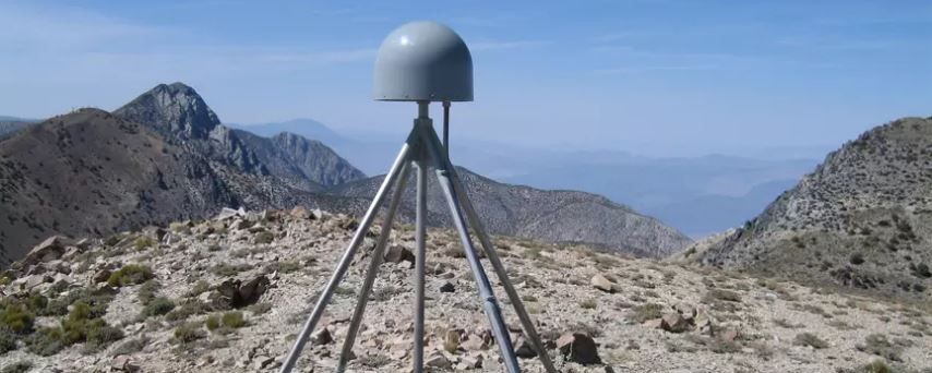
The data was gathered by stations built to measure earthquakes. Borsa said he was happy to find a new use for this existing network.
The drought has been particularly severe in California, and that's why the uplift there has been most notable, for example in the Sierra Nevadas. The old adage says faith can move mountains; whether that's true or not, drought definitely can.
Uncommon Knowledge
Newsweek is committed to challenging conventional wisdom and finding connections in the search for common ground.
Newsweek is committed to challenging conventional wisdom and finding connections in the search for common ground.
About the writer
Douglas Main is a journalist who lives in New York City and whose writing has appeared in the New York ... Read more
To read how Newsweek uses AI as a newsroom tool, Click here.