SlideShare a Scribd company logo
1 of 15
Download to read offline
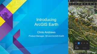
Introducing
ArcGIS Earth
Chris Andrews
Product Manager, 3D and ArcGIS Earth
ArcGIS Pro Powerful 2D/3D desktop authoring and data management
3D Analyst Rich analysis for advanced 3D workflows
CityEngine Advanced editing tool for Urban Designers
ArcGIS for Server Scalable 2D/3D enterprise content distribution and geoprocessing
ArcGIS Online Content and services for sharing ideas in 2D and 3D
ArcGIS Earth Easy-to-use 3D data exploration for Enterprise users
ArcGIS Runtime Developer tools for 2D and 3D custom solutions
ArcGIS
Marketplace
3rd party geospatial apps and data for the enterprise
3D across the Esri product family
ArcGIS Earth is an interactive globe viewer that
helps you explore any part of the world and work
with 3D and 2D map data including KML
ArcGIS Earth is…
Why are customers interested
in ArcGIS Earth?
• Need immediacy of KML or other file-based workflows
• Want lightweight user interface and familiar experience
• Benefit from extending the ArcGIS platform for communication
to stakeholders across the enterprise
Example ArcGIS Earth users
Field agent
Needs to quickly see
shared services,
automatically generated
shapefiles, and KML in a
secure network
Law Enforcement
GIS Administrator
Needs to deploy an app
across the enterprise
that provides a
common experience for
viewing map data in 3D
Commercial Real Estate
Student
Needs to view and
explore Living Atlas
data combined with
university-created data
for academic projects
Education
View basemaps and navigate the globe
Add KML, shapefiles, and services
Draw and measure
Share and save maps
Admin configuration
Supports Web Mercator and
WGS84 GCS
1.0 Capabilities
Explore basemaps in
ArcGIS Online or Portal
for ArcGIS Server
Zoom, Pan, Orbit with
mouse or keyboard
Personalize navigation
settings and atmosphere
Navigate using the TOC
Locate Points of Interest
View basemaps and navigate
Add KML, shapefiles, and services
Add KML/KMZ as files or
services
Add and style shapefiles
Add Esri RESTful services
Feature layers
Map services
Image services
3D Object scene layers
Draw and label 2D points,
paths, and polygons
Save drawing elements
in the TOC
Measure coordinate
locations, path
distances, and area
Draw and Measure
Send maps by email
Save map images
Print maps
Share and Save maps
Define proxy settings
Set default Portal
Set user profile location
Configure start-up layers
Configure point-based
service mouse interaction
Admin configuration
Streetview imagery shown is a demo example of Google Streetview integration
and does not imply endorsement of ArcGIS Earth or Esri by Google
ArcGIS Earth is free for download and use
Users of ArcGIS Earth can view publicly-shared data in ArcGIS Online
and Portal for ArcGIS without a Named User account
Protected data in Online and Portal requires Named User access
Some premium content in the Living Atlas requires a Named user
account
Download directly from http://j.mp/Earth1_0
Version 1.0 is English-only
Licensing
• DirectX
- Direct3D feature level 9_3
- Default: DirectX 11 hardware support with fallback to software rendering
• Hardware requirements
- CPU speed: 2.2 GHz or higher; Hyper-Threading Technology (HTT) or multicore
recommended.
- Processor: Intel Pentium 4, Intel Core Duo, or Xeon Processors; SSE2 minimum.
- Disk space:
- 50 MB install space
- 1.5 GB recommended for temp disk cache space
- 500 MB min swap space
- Memory/RAM: 2 GB or higher.
- Display: 24-bit color depth, 1024x768 or higher recommended at normal size (96 dpi).
- Video/Graphics adapter: 256 MB RAM minimum, 1 GB RAM recommended; NVIDIA, ATI,
and Intel chipsets supported;accelerated graphics card driver; Shader Model 4.0 minimum.
System requirements
Data courtesy Pictometry/PLW
Modelworks
Product pages – http://j.mp/Earth1_0
Help documentation – http://j.mp/Earth1_0Doc
GeoNet forum - http://j.mp/Earth1_0Forum
Twitter - @ArcGISEarth
More information and support
Thank you
candrews@esri.com
@_ChrisJAndrews
The information contained in this work is the exclusive property of Environmental Systems Research Institute, Inc. (Esri), and any respective copyright owners. This work is protected
under United States copyright law and other international copyright treaties and conventions.
Esri grants the recipient of the Esri information contained within the right to freely reproduce, redistribute, rebroadcast, and/or retransmit this information for personal, noncommercial
purposes, including teaching, classroom use, scholarship, and/or research, subject to the fair use rights enumerated in sections 107 and 108 of the Copyright Act (Title 17 of the
United States Code). All copies, whether in whole or in part, shall include the appropriate Esri copyright notice. Esri, ArcGIS and the Esri logo are registered trademarks of Esri.

More Related Content

What's hot

Esriuk_track5_mobile_solutions
Esriuk_track5_mobile_solutionsEsriuk_track5_mobile_solutions
Esriuk_track5_mobile_solutionsEsri UK
 
Esri South Africa ArcGIS 10.2 Rollout
Esri South Africa ArcGIS 10.2 Rollout Esri South Africa ArcGIS 10.2 Rollout
Esri South Africa ArcGIS 10.2 Rollout Esri South Africa
 
Working with ArcGIS Online
Working with ArcGIS OnlineWorking with ArcGIS Online
Working with ArcGIS OnlineEsri
 
ArcGIS
ArcGISArcGIS
ArcGISEsri
 
Esri 2016 User Conference - ArcGIS Online steps for success
Esri 2016 User Conference - ArcGIS Online steps for successEsri 2016 User Conference - ArcGIS Online steps for success
Esri 2016 User Conference - ArcGIS Online steps for successBern Szukalski
 
Evolution of Esri Data Formats Seminar
Evolution of Esri Data Formats SeminarEvolution of Esri Data Formats Seminar
Evolution of Esri Data Formats SeminarEsri South Africa
 
What's New for Cartography in ArcGIS 10.2
What's New for Cartography in ArcGIS 10.2What's New for Cartography in ArcGIS 10.2
What's New for Cartography in ArcGIS 10.2Aileen Buckley
 
StreetMap Premium for ArcGIS
StreetMap Premium for ArcGISStreetMap Premium for ArcGIS
StreetMap Premium for ArcGISEsri
 
Architecting the ArcGIS Platform
Architecting the ArcGIS PlatformArchitecting the ArcGIS Platform
Architecting the ArcGIS PlatformEsri UK
 
ArcGIS 10.2 for Server Functionality Matrix
ArcGIS 10.2 for Server Functionality MatrixArcGIS 10.2 for Server Functionality Matrix
ArcGIS 10.2 for Server Functionality MatrixEsri
 
Esri Ireland "ArcGIS - The Platform Story" Roadmap Session - Eamonn Doyle, Es...
Esri Ireland "ArcGIS - The Platform Story" Roadmap Session - Eamonn Doyle, Es...Esri Ireland "ArcGIS - The Platform Story" Roadmap Session - Eamonn Doyle, Es...
Esri Ireland "ArcGIS - The Platform Story" Roadmap Session - Eamonn Doyle, Es...Esri Ireland
 
Building ArcGIS Mobile Solutions in the Cloud
Building ArcGIS Mobile Solutions in the CloudBuilding ArcGIS Mobile Solutions in the Cloud
Building ArcGIS Mobile Solutions in the CloudAllan Laframboise
 
ArcGIS JavaScript API (build a web layer-based map application with html5 and...
ArcGIS JavaScript API (build a web layer-based map application with html5 and...ArcGIS JavaScript API (build a web layer-based map application with html5 and...
ArcGIS JavaScript API (build a web layer-based map application with html5 and...Stefano Marchisio
 

What's hot (20)

Esriuk_track5_mobile_solutions
Esriuk_track5_mobile_solutionsEsriuk_track5_mobile_solutions
Esriuk_track5_mobile_solutions
 
Esri South Africa ArcGIS 10.2 Rollout
Esri South Africa ArcGIS 10.2 Rollout Esri South Africa ArcGIS 10.2 Rollout
Esri South Africa ArcGIS 10.2 Rollout
 
Working with ArcGIS Online
Working with ArcGIS OnlineWorking with ArcGIS Online
Working with ArcGIS Online
 
ArcGIS
ArcGISArcGIS
ArcGIS
 
Esri 2016 User Conference - ArcGIS Online steps for success
Esri 2016 User Conference - ArcGIS Online steps for successEsri 2016 User Conference - ArcGIS Online steps for success
Esri 2016 User Conference - ArcGIS Online steps for success
 
Collector for ArcGIS
Collector for ArcGISCollector for ArcGIS
Collector for ArcGIS
 
Esri Map App Builders
Esri Map App BuildersEsri Map App Builders
Esri Map App Builders
 
Geocart workshop
Geocart workshopGeocart workshop
Geocart workshop
 
Evolution of Esri Data Formats Seminar
Evolution of Esri Data Formats SeminarEvolution of Esri Data Formats Seminar
Evolution of Esri Data Formats Seminar
 
Leveraging GIS with AutoCAD
Leveraging GIS with AutoCADLeveraging GIS with AutoCAD
Leveraging GIS with AutoCAD
 
What's New for Cartography in ArcGIS 10.2
What's New for Cartography in ArcGIS 10.2What's New for Cartography in ArcGIS 10.2
What's New for Cartography in ArcGIS 10.2
 
StreetMap Premium for ArcGIS
StreetMap Premium for ArcGISStreetMap Premium for ArcGIS
StreetMap Premium for ArcGIS
 
Architecting the ArcGIS Platform
Architecting the ArcGIS PlatformArchitecting the ArcGIS Platform
Architecting the ArcGIS Platform
 
High Accuracy Data Collection with Esri's Collector App
High Accuracy Data Collection with Esri's Collector AppHigh Accuracy Data Collection with Esri's Collector App
High Accuracy Data Collection with Esri's Collector App
 
ArcGIS 10.2 for Server Functionality Matrix
ArcGIS 10.2 for Server Functionality MatrixArcGIS 10.2 for Server Functionality Matrix
ArcGIS 10.2 for Server Functionality Matrix
 
Cartography and Web GIS - Jack Dangermond
Cartography and Web GIS - Jack DangermondCartography and Web GIS - Jack Dangermond
Cartography and Web GIS - Jack Dangermond
 
Esri Ireland "ArcGIS - The Platform Story" Roadmap Session - Eamonn Doyle, Es...
Esri Ireland "ArcGIS - The Platform Story" Roadmap Session - Eamonn Doyle, Es...Esri Ireland "ArcGIS - The Platform Story" Roadmap Session - Eamonn Doyle, Es...
Esri Ireland "ArcGIS - The Platform Story" Roadmap Session - Eamonn Doyle, Es...
 
Building ArcGIS Mobile Solutions in the Cloud
Building ArcGIS Mobile Solutions in the CloudBuilding ArcGIS Mobile Solutions in the Cloud
Building ArcGIS Mobile Solutions in the Cloud
 
ArcGIS JavaScript API (build a web layer-based map application with html5 and...
ArcGIS JavaScript API (build a web layer-based map application with html5 and...ArcGIS JavaScript API (build a web layer-based map application with html5 and...
ArcGIS JavaScript API (build a web layer-based map application with html5 and...
 
Arc gis server
Arc gis serverArc gis server
Arc gis server
 

Viewers also liked

Mapping fragility hotspots of a Mediterranean terraced system
Mapping fragility hotspots of a Mediterranean terraced systemMapping fragility hotspots of a Mediterranean terraced system
Mapping fragility hotspots of a Mediterranean terraced systemDavide Rizzo
 
Introduction to ArcGIS 10.1
Introduction to ArcGIS 10.1Introduction to ArcGIS 10.1
Introduction to ArcGIS 10.1Claudio Montoni
 
Geographical Information Systems and Science
Geographical Information Systems and ScienceGeographical Information Systems and Science
Geographical Information Systems and ScienceClaudio Montoni
 
نظريات التعليم والتعلم
نظريات التعليم والتعلمنظريات التعليم والتعلم
نظريات التعليم والتعلمIrcsa11
 
نظريات التعلم واستراتيجيات التدريس
نظريات التعلم واستراتيجيات التدريسنظريات التعلم واستراتيجيات التدريس
نظريات التعلم واستراتيجيات التدريسTeaching Skills
 
Cours Excel avance
Cours Excel avanceCours Excel avance
Cours Excel avancehassan1488
 
كتاب نظريات التعلم Pdf
كتاب نظريات التعلم Pdfكتاب نظريات التعلم Pdf
كتاب نظريات التعلم Pdfnoufa2003
 
Cours complet excel détaillé
Cours complet excel détailléCours complet excel détaillé
Cours complet excel détailléPaul Kamga
 
Excel 2010 - Fonctions et formules
Excel 2010 - Fonctions et formulesExcel 2010 - Fonctions et formules
Excel 2010 - Fonctions et formulesClaudio Montoni
 
Fonctions formules excel
Fonctions formules excelFonctions formules excel
Fonctions formules excelCarlitza
 

Viewers also liked (13)

Mapping fragility hotspots of a Mediterranean terraced system
Mapping fragility hotspots of a Mediterranean terraced systemMapping fragility hotspots of a Mediterranean terraced system
Mapping fragility hotspots of a Mediterranean terraced system
 
The Mathematics of GIS
The Mathematics of GISThe Mathematics of GIS
The Mathematics of GIS
 
Introduction to ArcGIS 10.1
Introduction to ArcGIS 10.1Introduction to ArcGIS 10.1
Introduction to ArcGIS 10.1
 
Geographical Information Systems and Science
Geographical Information Systems and ScienceGeographical Information Systems and Science
Geographical Information Systems and Science
 
Cours Excel
Cours ExcelCours Excel
Cours Excel
 
نظريات التعليم والتعلم
نظريات التعليم والتعلمنظريات التعليم والتعلم
نظريات التعليم والتعلم
 
نظريات التعلم واستراتيجيات التدريس
نظريات التعلم واستراتيجيات التدريسنظريات التعلم واستراتيجيات التدريس
نظريات التعلم واستراتيجيات التدريس
 
Cours Excel avance
Cours Excel avanceCours Excel avance
Cours Excel avance
 
كتاب نظريات التعلم Pdf
كتاب نظريات التعلم Pdfكتاب نظريات التعلم Pdf
كتاب نظريات التعلم Pdf
 
Excel 2010
Excel 2010Excel 2010
Excel 2010
 
Cours complet excel détaillé
Cours complet excel détailléCours complet excel détaillé
Cours complet excel détaillé
 
Excel 2010 - Fonctions et formules
Excel 2010 - Fonctions et formulesExcel 2010 - Fonctions et formules
Excel 2010 - Fonctions et formules
 
Fonctions formules excel
Fonctions formules excelFonctions formules excel
Fonctions formules excel
 

Similar to Introducing ArcGIS Earth - January 2016

Esriuk_track5_pro_launch
Esriuk_track5_pro_launchEsriuk_track5_pro_launch
Esriuk_track5_pro_launchEsri UK
 
ArcGIS 10.1 for Server Functionality Matrix
ArcGIS 10.1 for Server Functionality MatrixArcGIS 10.1 for Server Functionality Matrix
ArcGIS 10.1 for Server Functionality MatrixEsri
 
Best practices for_managing_geospatial_data1
Best practices for_managing_geospatial_data1Best practices for_managing_geospatial_data1
Best practices for_managing_geospatial_data1Leng Kim Leng
 
Arcgis server-functionality-matrix
Arcgis server-functionality-matrixArcgis server-functionality-matrix
Arcgis server-functionality-matrixEsri
 
Web enabling your survey business ppt version
Web enabling your survey business ppt versionWeb enabling your survey business ppt version
Web enabling your survey business ppt versionrudy_stricklan
 
Dsm Presentation
Dsm PresentationDsm Presentation
Dsm Presentationrichoe
 
Internet-enabled GIS for Planners
Internet-enabled GIS for PlannersInternet-enabled GIS for Planners
Internet-enabled GIS for PlannersJohn Reiser
 
Getting to Know ArcGIS Pro
Getting to Know ArcGIS ProGetting to Know ArcGIS Pro
Getting to Know ArcGIS ProEsri UK
 
webgis architecture and practices patterns
webgis architecture and practices patternswebgis architecture and practices patterns
webgis architecture and practices patternsNguyenVanTuan33
 
Open Source GIS Workshop
Open Source GIS WorkshopOpen Source GIS Workshop
Open Source GIS WorkshopJason Dalton
 
Not Just Dots on a Map: How Geography Influences Real World Decisions Part 2
Not Just Dots on a Map: How Geography Influences Real World Decisions Part 2Not Just Dots on a Map: How Geography Influences Real World Decisions Part 2
Not Just Dots on a Map: How Geography Influences Real World Decisions Part 2American Public Gardens Association
 
Welsh Conference 2023 Opening Plenary
Welsh Conference 2023 Opening PlenaryWelsh Conference 2023 Opening Plenary
Welsh Conference 2023 Opening PlenaryEsri UK
 
Super map gis 8c
Super map gis 8cSuper map gis 8c
Super map gis 8cDaniel PI
 
Strategies for Integrating Utility System Operational Data into ArcGIS Server...
Strategies for Integrating Utility System Operational Data into ArcGIS Server...Strategies for Integrating Utility System Operational Data into ArcGIS Server...
Strategies for Integrating Utility System Operational Data into ArcGIS Server...True North Geographic Technologies
 
Desktop Softwares for Unmanned Aerial Systems(UAS))
Desktop Softwares for Unmanned Aerial Systems(UAS))Desktop Softwares for Unmanned Aerial Systems(UAS))
Desktop Softwares for Unmanned Aerial Systems(UAS))Kamal Shahi
 
What's Coming At ArcGIS 10.1 - CSRA GIS User Group Meeting
What's Coming At ArcGIS 10.1 - CSRA GIS User Group MeetingWhat's Coming At ArcGIS 10.1 - CSRA GIS User Group Meeting
What's Coming At ArcGIS 10.1 - CSRA GIS User Group MeetingJim Tochterman
 
ArcGIS 10.2.x for Server Functionality Matrix
ArcGIS 10.2.x for Server Functionality MatrixArcGIS 10.2.x for Server Functionality Matrix
ArcGIS 10.2.x for Server Functionality MatrixEsri
 
2016 workshops: understanding the language of gis and cad by warren geissler
2016 workshops:  understanding  the language  of gis and cad by warren geissler2016 workshops:  understanding  the language  of gis and cad by warren geissler
2016 workshops: understanding the language of gis and cad by warren geisslerGIS in the Rockies
 
3D Visualization in ArcGIS Pro
3D Visualization in ArcGIS Pro3D Visualization in ArcGIS Pro
3D Visualization in ArcGIS Prothangqd
 
Architecting the ArcGIS Platform - Technical - Esri UK Annual Conference 2017
Architecting the ArcGIS Platform - Technical - Esri UK Annual Conference 2017Architecting the ArcGIS Platform - Technical - Esri UK Annual Conference 2017
Architecting the ArcGIS Platform - Technical - Esri UK Annual Conference 2017Esri UK
 

Similar to Introducing ArcGIS Earth - January 2016 (20)

Esriuk_track5_pro_launch
Esriuk_track5_pro_launchEsriuk_track5_pro_launch
Esriuk_track5_pro_launch
 
ArcGIS 10.1 for Server Functionality Matrix
ArcGIS 10.1 for Server Functionality MatrixArcGIS 10.1 for Server Functionality Matrix
ArcGIS 10.1 for Server Functionality Matrix
 
Best practices for_managing_geospatial_data1
Best practices for_managing_geospatial_data1Best practices for_managing_geospatial_data1
Best practices for_managing_geospatial_data1
 
Arcgis server-functionality-matrix
Arcgis server-functionality-matrixArcgis server-functionality-matrix
Arcgis server-functionality-matrix
 
Web enabling your survey business ppt version
Web enabling your survey business ppt versionWeb enabling your survey business ppt version
Web enabling your survey business ppt version
 
Dsm Presentation
Dsm PresentationDsm Presentation
Dsm Presentation
 
Internet-enabled GIS for Planners
Internet-enabled GIS for PlannersInternet-enabled GIS for Planners
Internet-enabled GIS for Planners
 
Getting to Know ArcGIS Pro
Getting to Know ArcGIS ProGetting to Know ArcGIS Pro
Getting to Know ArcGIS Pro
 
webgis architecture and practices patterns
webgis architecture and practices patternswebgis architecture and practices patterns
webgis architecture and practices patterns
 
Open Source GIS Workshop
Open Source GIS WorkshopOpen Source GIS Workshop
Open Source GIS Workshop
 
Not Just Dots on a Map: How Geography Influences Real World Decisions Part 2
Not Just Dots on a Map: How Geography Influences Real World Decisions Part 2Not Just Dots on a Map: How Geography Influences Real World Decisions Part 2
Not Just Dots on a Map: How Geography Influences Real World Decisions Part 2
 
Welsh Conference 2023 Opening Plenary
Welsh Conference 2023 Opening PlenaryWelsh Conference 2023 Opening Plenary
Welsh Conference 2023 Opening Plenary
 
Super map gis 8c
Super map gis 8cSuper map gis 8c
Super map gis 8c
 
Strategies for Integrating Utility System Operational Data into ArcGIS Server...
Strategies for Integrating Utility System Operational Data into ArcGIS Server...Strategies for Integrating Utility System Operational Data into ArcGIS Server...
Strategies for Integrating Utility System Operational Data into ArcGIS Server...
 
Desktop Softwares for Unmanned Aerial Systems(UAS))
Desktop Softwares for Unmanned Aerial Systems(UAS))Desktop Softwares for Unmanned Aerial Systems(UAS))
Desktop Softwares for Unmanned Aerial Systems(UAS))
 
What's Coming At ArcGIS 10.1 - CSRA GIS User Group Meeting
What's Coming At ArcGIS 10.1 - CSRA GIS User Group MeetingWhat's Coming At ArcGIS 10.1 - CSRA GIS User Group Meeting
What's Coming At ArcGIS 10.1 - CSRA GIS User Group Meeting
 
ArcGIS 10.2.x for Server Functionality Matrix
ArcGIS 10.2.x for Server Functionality MatrixArcGIS 10.2.x for Server Functionality Matrix
ArcGIS 10.2.x for Server Functionality Matrix
 
2016 workshops: understanding the language of gis and cad by warren geissler
2016 workshops:  understanding  the language  of gis and cad by warren geissler2016 workshops:  understanding  the language  of gis and cad by warren geissler
2016 workshops: understanding the language of gis and cad by warren geissler
 
3D Visualization in ArcGIS Pro
3D Visualization in ArcGIS Pro3D Visualization in ArcGIS Pro
3D Visualization in ArcGIS Pro
 
Architecting the ArcGIS Platform - Technical - Esri UK Annual Conference 2017
Architecting the ArcGIS Platform - Technical - Esri UK Annual Conference 2017Architecting the ArcGIS Platform - Technical - Esri UK Annual Conference 2017
Architecting the ArcGIS Platform - Technical - Esri UK Annual Conference 2017
 

Recently uploaded

Repurposing LNG terminals for Hydrogen Ammonia: Feasibility and Cost Saving
Repurposing LNG terminals for Hydrogen Ammonia: Feasibility and Cost SavingRepurposing LNG terminals for Hydrogen Ammonia: Feasibility and Cost Saving
Repurposing LNG terminals for Hydrogen Ammonia: Feasibility and Cost SavingEdi Saputra
 
Powerful Google developer tools for immediate impact! (2023-24 C)
Powerful Google developer tools for immediate impact! (2023-24 C)Powerful Google developer tools for immediate impact! (2023-24 C)
Powerful Google developer tools for immediate impact! (2023-24 C)wesley chun
 
How to Troubleshoot Apps for the Modern Connected Worker
How to Troubleshoot Apps for the Modern Connected WorkerHow to Troubleshoot Apps for the Modern Connected Worker
How to Troubleshoot Apps for the Modern Connected WorkerThousandEyes
 
Automating Google Workspace (GWS) & more with Apps Script
Automating Google Workspace (GWS) & more with Apps ScriptAutomating Google Workspace (GWS) & more with Apps Script
Automating Google Workspace (GWS) & more with Apps Scriptwesley chun
 
Cloud Frontiers: A Deep Dive into Serverless Spatial Data and FME
Cloud Frontiers:  A Deep Dive into Serverless Spatial Data and FMECloud Frontiers:  A Deep Dive into Serverless Spatial Data and FME
Cloud Frontiers: A Deep Dive into Serverless Spatial Data and FMESafe Software
 
Boost PC performance: How more available memory can improve productivity
Boost PC performance: How more available memory can improve productivityBoost PC performance: How more available memory can improve productivity
Boost PC performance: How more available memory can improve productivityPrincipled Technologies
 
Mastering MySQL Database Architecture: Deep Dive into MySQL Shell and MySQL R...
Mastering MySQL Database Architecture: Deep Dive into MySQL Shell and MySQL R...Mastering MySQL Database Architecture: Deep Dive into MySQL Shell and MySQL R...
Mastering MySQL Database Architecture: Deep Dive into MySQL Shell and MySQL R...Miguel Araújo
 
Understanding Discord NSFW Servers A Guide for Responsible Users.pdf
Understanding Discord NSFW Servers A Guide for Responsible Users.pdfUnderstanding Discord NSFW Servers A Guide for Responsible Users.pdf
Understanding Discord NSFW Servers A Guide for Responsible Users.pdfUK Journal
 
The 7 Things I Know About Cyber Security After 25 Years | April 2024
The 7 Things I Know About Cyber Security After 25 Years | April 2024The 7 Things I Know About Cyber Security After 25 Years | April 2024
The 7 Things I Know About Cyber Security After 25 Years | April 2024Rafal Los
 
Data Cloud, More than a CDP by Matt Robison
Data Cloud, More than a CDP by Matt RobisonData Cloud, More than a CDP by Matt Robison
Data Cloud, More than a CDP by Matt RobisonAnna Loughnan Colquhoun
 
Top 10 Most Downloaded Games on Play Store in 2024
Top 10 Most Downloaded Games on Play Store in 2024Top 10 Most Downloaded Games on Play Store in 2024
Top 10 Most Downloaded Games on Play Store in 2024SynarionITSolutions
 
A Year of the Servo Reboot: Where Are We Now?
A Year of the Servo Reboot: Where Are We Now?A Year of the Servo Reboot: Where Are We Now?
A Year of the Servo Reboot: Where Are We Now?Igalia
 
Boost Fertility New Invention Ups Success Rates.pdf
Boost Fertility New Invention Ups Success Rates.pdfBoost Fertility New Invention Ups Success Rates.pdf
Boost Fertility New Invention Ups Success Rates.pdfsudhanshuwaghmare1
 
Artificial Intelligence: Facts and Myths
Artificial Intelligence: Facts and MythsArtificial Intelligence: Facts and Myths
Artificial Intelligence: Facts and MythsJoaquim Jorge
 
Manulife - Insurer Innovation Award 2024
Manulife - Insurer Innovation Award 2024Manulife - Insurer Innovation Award 2024
Manulife - Insurer Innovation Award 2024The Digital Insurer
 
Deploy with confidence: VMware Cloud Foundation 5.1 on next gen Dell PowerEdg...
Deploy with confidence: VMware Cloud Foundation 5.1 on next gen Dell PowerEdg...Deploy with confidence: VMware Cloud Foundation 5.1 on next gen Dell PowerEdg...
Deploy with confidence: VMware Cloud Foundation 5.1 on next gen Dell PowerEdg...Principled Technologies
 
TrustArc Webinar - Stay Ahead of US State Data Privacy Law Developments
TrustArc Webinar - Stay Ahead of US State Data Privacy Law DevelopmentsTrustArc Webinar - Stay Ahead of US State Data Privacy Law Developments
TrustArc Webinar - Stay Ahead of US State Data Privacy Law DevelopmentsTrustArc
 
Apidays New York 2024 - Scaling API-first by Ian Reasor and Radu Cotescu, Adobe
Apidays New York 2024 - Scaling API-first by Ian Reasor and Radu Cotescu, AdobeApidays New York 2024 - Scaling API-first by Ian Reasor and Radu Cotescu, Adobe
Apidays New York 2024 - Scaling API-first by Ian Reasor and Radu Cotescu, Adobeapidays
 
Artificial Intelligence Chap.5 : Uncertainty
Artificial Intelligence Chap.5 : UncertaintyArtificial Intelligence Chap.5 : Uncertainty
Artificial Intelligence Chap.5 : UncertaintyKhushali Kathiriya
 

Recently uploaded (20)

Repurposing LNG terminals for Hydrogen Ammonia: Feasibility and Cost Saving
Repurposing LNG terminals for Hydrogen Ammonia: Feasibility and Cost SavingRepurposing LNG terminals for Hydrogen Ammonia: Feasibility and Cost Saving
Repurposing LNG terminals for Hydrogen Ammonia: Feasibility and Cost Saving
 
Powerful Google developer tools for immediate impact! (2023-24 C)
Powerful Google developer tools for immediate impact! (2023-24 C)Powerful Google developer tools for immediate impact! (2023-24 C)
Powerful Google developer tools for immediate impact! (2023-24 C)
 
How to Troubleshoot Apps for the Modern Connected Worker
How to Troubleshoot Apps for the Modern Connected WorkerHow to Troubleshoot Apps for the Modern Connected Worker
How to Troubleshoot Apps for the Modern Connected Worker
 
Automating Google Workspace (GWS) & more with Apps Script
Automating Google Workspace (GWS) & more with Apps ScriptAutomating Google Workspace (GWS) & more with Apps Script
Automating Google Workspace (GWS) & more with Apps Script
 
Cloud Frontiers: A Deep Dive into Serverless Spatial Data and FME
Cloud Frontiers:  A Deep Dive into Serverless Spatial Data and FMECloud Frontiers:  A Deep Dive into Serverless Spatial Data and FME
Cloud Frontiers: A Deep Dive into Serverless Spatial Data and FME
 
Boost PC performance: How more available memory can improve productivity
Boost PC performance: How more available memory can improve productivityBoost PC performance: How more available memory can improve productivity
Boost PC performance: How more available memory can improve productivity
 
Mastering MySQL Database Architecture: Deep Dive into MySQL Shell and MySQL R...
Mastering MySQL Database Architecture: Deep Dive into MySQL Shell and MySQL R...Mastering MySQL Database Architecture: Deep Dive into MySQL Shell and MySQL R...
Mastering MySQL Database Architecture: Deep Dive into MySQL Shell and MySQL R...
 
Understanding Discord NSFW Servers A Guide for Responsible Users.pdf
Understanding Discord NSFW Servers A Guide for Responsible Users.pdfUnderstanding Discord NSFW Servers A Guide for Responsible Users.pdf
Understanding Discord NSFW Servers A Guide for Responsible Users.pdf
 
The 7 Things I Know About Cyber Security After 25 Years | April 2024
The 7 Things I Know About Cyber Security After 25 Years | April 2024The 7 Things I Know About Cyber Security After 25 Years | April 2024
The 7 Things I Know About Cyber Security After 25 Years | April 2024
 
Data Cloud, More than a CDP by Matt Robison
Data Cloud, More than a CDP by Matt RobisonData Cloud, More than a CDP by Matt Robison
Data Cloud, More than a CDP by Matt Robison
 
Top 10 Most Downloaded Games on Play Store in 2024
Top 10 Most Downloaded Games on Play Store in 2024Top 10 Most Downloaded Games on Play Store in 2024
Top 10 Most Downloaded Games on Play Store in 2024
 
A Year of the Servo Reboot: Where Are We Now?
A Year of the Servo Reboot: Where Are We Now?A Year of the Servo Reboot: Where Are We Now?
A Year of the Servo Reboot: Where Are We Now?
 
Boost Fertility New Invention Ups Success Rates.pdf
Boost Fertility New Invention Ups Success Rates.pdfBoost Fertility New Invention Ups Success Rates.pdf
Boost Fertility New Invention Ups Success Rates.pdf
 
Artificial Intelligence: Facts and Myths
Artificial Intelligence: Facts and MythsArtificial Intelligence: Facts and Myths
Artificial Intelligence: Facts and Myths
 
Manulife - Insurer Innovation Award 2024
Manulife - Insurer Innovation Award 2024Manulife - Insurer Innovation Award 2024
Manulife - Insurer Innovation Award 2024
 
Deploy with confidence: VMware Cloud Foundation 5.1 on next gen Dell PowerEdg...
Deploy with confidence: VMware Cloud Foundation 5.1 on next gen Dell PowerEdg...Deploy with confidence: VMware Cloud Foundation 5.1 on next gen Dell PowerEdg...
Deploy with confidence: VMware Cloud Foundation 5.1 on next gen Dell PowerEdg...
 
TrustArc Webinar - Stay Ahead of US State Data Privacy Law Developments
TrustArc Webinar - Stay Ahead of US State Data Privacy Law DevelopmentsTrustArc Webinar - Stay Ahead of US State Data Privacy Law Developments
TrustArc Webinar - Stay Ahead of US State Data Privacy Law Developments
 
Apidays New York 2024 - Scaling API-first by Ian Reasor and Radu Cotescu, Adobe
Apidays New York 2024 - Scaling API-first by Ian Reasor and Radu Cotescu, AdobeApidays New York 2024 - Scaling API-first by Ian Reasor and Radu Cotescu, Adobe
Apidays New York 2024 - Scaling API-first by Ian Reasor and Radu Cotescu, Adobe
 
+971581248768>> SAFE AND ORIGINAL ABORTION PILLS FOR SALE IN DUBAI AND ABUDHA...
+971581248768>> SAFE AND ORIGINAL ABORTION PILLS FOR SALE IN DUBAI AND ABUDHA...+971581248768>> SAFE AND ORIGINAL ABORTION PILLS FOR SALE IN DUBAI AND ABUDHA...
+971581248768>> SAFE AND ORIGINAL ABORTION PILLS FOR SALE IN DUBAI AND ABUDHA...
 
Artificial Intelligence Chap.5 : Uncertainty
Artificial Intelligence Chap.5 : UncertaintyArtificial Intelligence Chap.5 : Uncertainty
Artificial Intelligence Chap.5 : Uncertainty
 

Introducing ArcGIS Earth - January 2016

  • 1. Introducing ArcGIS Earth Chris Andrews Product Manager, 3D and ArcGIS Earth
  • 2. ArcGIS Pro Powerful 2D/3D desktop authoring and data management 3D Analyst Rich analysis for advanced 3D workflows CityEngine Advanced editing tool for Urban Designers ArcGIS for Server Scalable 2D/3D enterprise content distribution and geoprocessing ArcGIS Online Content and services for sharing ideas in 2D and 3D ArcGIS Earth Easy-to-use 3D data exploration for Enterprise users ArcGIS Runtime Developer tools for 2D and 3D custom solutions ArcGIS Marketplace 3rd party geospatial apps and data for the enterprise 3D across the Esri product family
  • 3. ArcGIS Earth is an interactive globe viewer that helps you explore any part of the world and work with 3D and 2D map data including KML ArcGIS Earth is…
  • 4. Why are customers interested in ArcGIS Earth? • Need immediacy of KML or other file-based workflows • Want lightweight user interface and familiar experience • Benefit from extending the ArcGIS platform for communication to stakeholders across the enterprise
  • 5. Example ArcGIS Earth users Field agent Needs to quickly see shared services, automatically generated shapefiles, and KML in a secure network Law Enforcement GIS Administrator Needs to deploy an app across the enterprise that provides a common experience for viewing map data in 3D Commercial Real Estate Student Needs to view and explore Living Atlas data combined with university-created data for academic projects Education
  • 6. View basemaps and navigate the globe Add KML, shapefiles, and services Draw and measure Share and save maps Admin configuration Supports Web Mercator and WGS84 GCS 1.0 Capabilities
  • 7. Explore basemaps in ArcGIS Online or Portal for ArcGIS Server Zoom, Pan, Orbit with mouse or keyboard Personalize navigation settings and atmosphere Navigate using the TOC Locate Points of Interest View basemaps and navigate
  • 8. Add KML, shapefiles, and services Add KML/KMZ as files or services Add and style shapefiles Add Esri RESTful services Feature layers Map services Image services 3D Object scene layers
  • 9. Draw and label 2D points, paths, and polygons Save drawing elements in the TOC Measure coordinate locations, path distances, and area Draw and Measure
  • 10. Send maps by email Save map images Print maps Share and Save maps
  • 11. Define proxy settings Set default Portal Set user profile location Configure start-up layers Configure point-based service mouse interaction Admin configuration Streetview imagery shown is a demo example of Google Streetview integration and does not imply endorsement of ArcGIS Earth or Esri by Google
  • 12. ArcGIS Earth is free for download and use Users of ArcGIS Earth can view publicly-shared data in ArcGIS Online and Portal for ArcGIS without a Named User account Protected data in Online and Portal requires Named User access Some premium content in the Living Atlas requires a Named user account Download directly from http://j.mp/Earth1_0 Version 1.0 is English-only Licensing
  • 13. • DirectX - Direct3D feature level 9_3 - Default: DirectX 11 hardware support with fallback to software rendering • Hardware requirements - CPU speed: 2.2 GHz or higher; Hyper-Threading Technology (HTT) or multicore recommended. - Processor: Intel Pentium 4, Intel Core Duo, or Xeon Processors; SSE2 minimum. - Disk space: - 50 MB install space - 1.5 GB recommended for temp disk cache space - 500 MB min swap space - Memory/RAM: 2 GB or higher. - Display: 24-bit color depth, 1024x768 or higher recommended at normal size (96 dpi). - Video/Graphics adapter: 256 MB RAM minimum, 1 GB RAM recommended; NVIDIA, ATI, and Intel chipsets supported;accelerated graphics card driver; Shader Model 4.0 minimum. System requirements Data courtesy Pictometry/PLW Modelworks
  • 14. Product pages – http://j.mp/Earth1_0 Help documentation – http://j.mp/Earth1_0Doc GeoNet forum - http://j.mp/Earth1_0Forum Twitter - @ArcGISEarth More information and support
  • 15. Thank you candrews@esri.com @_ChrisJAndrews The information contained in this work is the exclusive property of Environmental Systems Research Institute, Inc. (Esri), and any respective copyright owners. This work is protected under United States copyright law and other international copyright treaties and conventions. Esri grants the recipient of the Esri information contained within the right to freely reproduce, redistribute, rebroadcast, and/or retransmit this information for personal, noncommercial purposes, including teaching, classroom use, scholarship, and/or research, subject to the fair use rights enumerated in sections 107 and 108 of the Copyright Act (Title 17 of the United States Code). All copies, whether in whole or in part, shall include the appropriate Esri copyright notice. Esri, ArcGIS and the Esri logo are registered trademarks of Esri.