Last year I published a brief article and video on adding content into ArcGIS Earth. It turns out that I forgot one of the most important items… the list of services that we publish through ArcGIS Online that you can use!
Here are some example services that will work in ArcGIS Earth. You can drag-and-drop, add by URL, or even find them in the Online search (though we have a couple of issues we’re fixing to make that easier).
Building Scene Services
- Auckland LoD1 non-textured
- Basel LoD2 non-textured
- Berlin LoD2 non-textured
- Brest LoD2 non-textured with hero textured LoD3 buildings
- Boston LoD1 non-textured
- Denver LoD1 non-textured
- Geneva LoD2 non-textured
- Hamburg LoD1 non-textured
- Johannesburg LoD2 non-textured
- Linz LoD2 non-textured
- Montreal LoD2 non-textured
- Montreal LoD2 Textured
- New York City untextured
- Portland LoD1 untextured
- Rotterdam LoD2 untextured
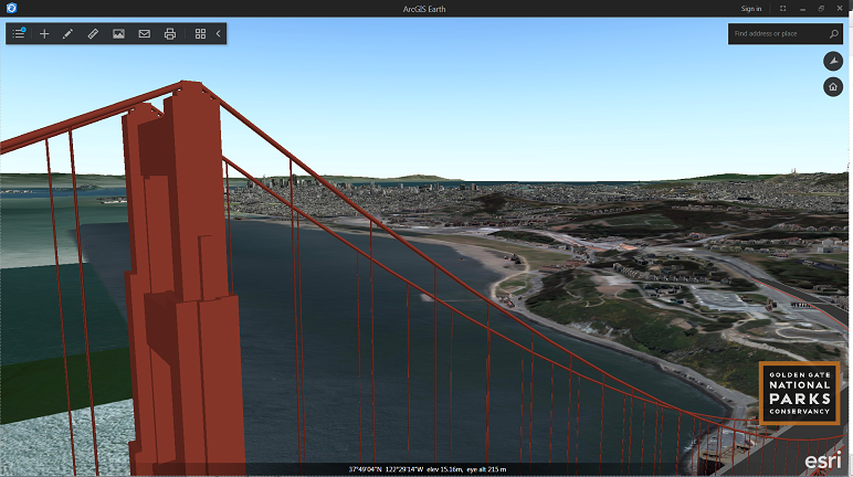
- San Francisco textured Pictometry data
- Vancouver LoD2 untextured
- Washington DC untextured
Examples of other types of services that will work in Earth
Many other services will work in Earth and we are constantly improving capabilities. These are a couple of examples of services that I have tried from public ArcGIS Online links:
- https://gis.internationalmedicalcorps.org/arcgis/rest/services/Nepal/Nepal_Earthquake_2015_data/FeatureServer
- http://hydrology.esri.com/arcgis/rest/services/WorldHydroReferenceOverlay/MapServer
- http://imagery.arcgisonline.com/ArcGIS/rest/services/LandsatGLS/FalseColor/ImageServer
Let us know what you’re able to do with these services!
If you haven’t downloaded it yet, you can get ArcGIS Earth here.

Commenting is not enabled for this article.