Showing posts with label superhighways. Show all posts

Monday 16 July 2012

The first Fietsroute+ in Groningen

Not all major cycle-routes are given a particularly grand name in the Netherlands. While other countries use terms such as "superhighway" for mere cycle-lanes, in this country, more modest terms are used for very good and direct cycle-paths. One of these terms is "Fietsroute+", favoured by the Groningen-Assen region.

My mother helping me to demonstrate
the Assen-Rolde Fietsroute+
The first Fietsroute+ was constructed in 2007 to cover the 10 km distance between Assen and Vries. For a couple of years, this featured on my commute, and the wonderful smooth surface and continuity of the path helped with riding at high enough average speeds that a 60 km round trip was quite feasible. This particular routes has also featured in several blog posts including about the required standards for a Fietsroute+ (worth reading) and how it is used by many secondary school students. Another Fietsroute+ heads East out of Assen, covering the 6 km distance between Rolde and Assen.

However, both of these are in Drenthe, not in Groningen and this post is about the First Fietsroute+ in the province of Groningen.

Two years ago, Wilfred took some photos of the construction of a new Fietsroute+ to make the 13 km distance between his home in Zuidhorn and Groningen more attractive to cyclists. This cycle-path was finally completed and officially opened in May as the first Fietsroute+ in Groningen. The local government produced a publicity film for it in which the entertainer Arno Van Der Heyden introduces the new fietsroute+, demonstrates how to cycle along the route, and interviews the burgemeester of Zuidhorn, a passer by, and the cycling project leader about the new cycle-path:


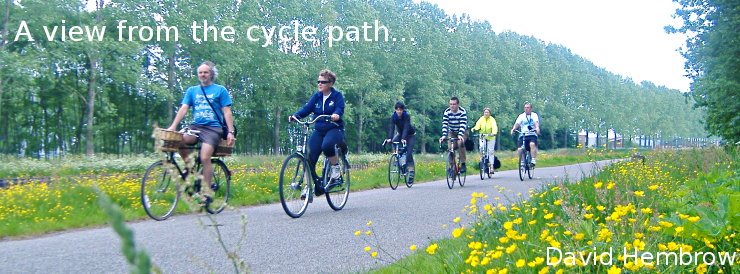
Like the other Fietsroute+ routes, as well as other major routes without that designation, it's designed to be safe, wide to avoid conflict, and smooth and direct to cope with higher speeds than an average cycle-path. The combined population of Zuidhorn and surrounding smaller villages is only around 18000, yet 1500 people per day cycle along this route. Their numbers are boosted by people for whom this section is part of a longer route. It is hoped that the quality of the new cycle-path will attract yet more people out of cars.

However, this wasn't the only publicity. There was another event, an opening "race":

The winner of this "race" was professional cycle racer Bauke Mollema. Bauke Mollema grew up in Zuidhorn and rode to Groningen each day to go to school. He tells an amusing anecdote about how when he made his school journeys along the old path, they would ride with two students next to each other and it too cramped for three, while with the new improved path five abreast will be possible. I've seen how school children and students cycle, and I've no doubt that this will happen.

Bauke is a local hero. This year he took part in the Tour de France, though sadly he had to stop after the 11th stage due to problems from injuries suffered on the sixth stage. Better luck next time !

Progress continues to be made so that cycling becomes steadily safer, faster and more attractive. Seven routes are currently shown as either completed or in progress on the Groningen-Assen website, and another fietsroute+ is also planned to be built along the line of the railway to Winsum, some 15 km North of Groningen:

It is only by continual improvement that cycling can be expected to grow. Standards are so high as they are in the Nnetherlands because they need to be higher here than elsewhere merely to preserve the modal share which already exists, let alone to make it grow. While it is relatively easy to convince the first few percent of the population to cycle because they are the least demanding, if the modal share is to become higher, it becomes steadily more difficult because the target is no longer "low lying fruit". Rather, to maintain and build on a high modal share for cycling, the target audience is necessarily those people who are not easy to convince to ride a bike. They may have longer journeys, be more easily scared off from cycling, come from from demographic groups who are less likely to cycle, or perhaps they simply more likely to prefer an alternative such as driving a car.

This is why development of ever better cycling facilities is not a luxury but a necessity not only in the Netherlands but also elsewhere. Campaigners can make no progress by asking only for what is good enough for themselves. Such campaigners are themselves the low-lying fruit and they are already riding. For progress, the standards have to improve and this isn't achieved by aiming low. The benefit of good quality cycling facilities is for everyone, even professional cycle-racers.


In related news, Bauke became a father last week. Gefeliciteerd Bauke en Jane !

Monday 27 June 2011

Cycling infrastructure is cheaper to build than not to build

I've often written before about the growing network of inter-city cycling superhighways in the Netherlands.

Sometimes people wonder how the country can afford to build such infrastructure for cyclists. However, given the benefits which accumulate to the country from increased cycle usage, cycling should never be seen as a cost so much as as a benefit.

A new report from the Fietsberaad spells this out for the superhighways:

The proceeds that can be attributed to bicycle highways considerably outweigh the costs. The next couple of years approximately €100 million will be invested in bicycle highways in the Netherlands. That will lead to future annual profits of at least €144 million in travel time gained, better health and environmental benefits.
plaatje
Goudappel Coffeng consultants has calculated this by means of a traffic model. It employed two different scenarios: one involving the construction of 675 km of bicycle highways and another one with the additional assumption that by 2020 half of all cyclists will employ an electric bicycle.
The number of car journeys will fall by 0.7% in the first scenario and if the electric bicycle continues its advance, by 1.6%. The number of journeys by public transport falls more: by 0.9% and 2.7% respectively. The number of bicycle journeys increases by 1.3 and 3.3% respectively.
Goudappel also studied the mobility effects for the region Rotterdam/Den Haag in particular. There car use decreases by 1.4 and 2.3% respectively and public transport by 2.3 and 3.9% respectively. The number of bicycle journeys increases there by 2.2 and 3.8% respectively.
For the entire country, improved bicycle provisions will cause travel times by car to fall by 3.8 million hours, as a result of less congestion, and 9.4 million hours due to increased use of electric bikes respectively. Assuming a value of € 10 for an hour’s travel by car, this will yield approximately € 40 million a year in the case with only bicycle highways, growing to €100 million with bicycle highways in combination with an increased use of electric bicycles. Health effects will contribute another €250 million to the ‘electric scenario’ according to the model calculation, as well as €8 million thanks to the CO2 reduction. Overall this leads to a profit of €358 million. For the scenario without electric bicycles Goudappel calculates proceeds of €144 million annually.

While it's normally quicker to cycle than to drive in the Netherlands, it's also worth reflecting on that cycle infrastructure makes journeys better for drivers too.

Friday 3 December 2010

Sixteen new long distance cycle routes

It's just been announced that 16 new long distance inter-city cycle routes will be built across the country with central government support of 21 million euros and local council support making up the rest of the 80 million euro combined cost of the schemes.

The new routes are targeting places where presently there are traffic jams on the roads, the intention is to convince drivers to cycle. Not only commuters, but also employers are interested. Cyclists are less likely to be ill, need no car parking space, have more reliable working hours due to not getting stuck in traffic jams, and also improve the environment.

These routes are particularly planned to support existing busy commuting routes of up to 15 km in each direction as this is seen as a distance which you can reasonably expect people to ride.

The existing cycle paths will be upgraded to have better surfaces, better signs and better lighting. Also there will be improvements to bridges and tunnels.

A faster cycling route improves how well cycling competes with driving. The potential is large because more than half of all commutes in the Netherlands are over a distance of under 15 km.


In the Netherlands, 35% of all journeys under 7.5 km are already by bicycle. Also, 15% of journeys between 7.5 km and 15 km take place by bike. For all distances over 15 km, the numbers drop to just 3% of journeys. However, even for these longer distances that's still a larger percentage by bike than people make even of short journeys in many other countries.

See more articles about funding. It's not entirely clear how much of the money here is new, and how much comes from the existing pot. Also see more articles about the Netherlands' growing network of intercity superhighways for bicycles.

Thanks to both my colleague Harry, and also intercityfietser who both alerted me to this. It's infrastructure on a country sized scale, not merely a city sized scale. But in the usual Dutch way it's being talked about rather modestly, and has not been the subject of press releases sent all around the world...


The statistics for cycling modal share over different distances came from "Cycling In The Netherlands", one of the documents linked from our articles page.

Monday 4 October 2010

Mobility man - cycle superhighway


This is one of a series of promotional films about transport produced by the Nijmegen / Arnhem region.

The action largely takes place on the snelbinder cycling bridge in Nijmegen.

The man at the start is asking about a "fietssnelweg" between Nijmegen and Arnhem. The two cities are roughly 18 km / 11 miles apart. The presenter goes on to explain that when distances are greater than around 15 km, this can be offputting to a lot of cyclists, so the conditions need to be made better for cycling, so that the route is more attractive for cycling, and that's the way to get more people to cycle. They also need to encourage bicycles more suitable for longer distances.

This fietssnelweg is still in development. It is expected to be complete in 2012. There is a website for it and currently a competition is being held where people can contribute their ideas for how the route can be made better.

At the end you see a glimpse of what is claimed to be the fastest cycle courier service in the world - a velomobile used daily to take packets between Nijmegen and Arnhem. However, it appears that the local government actually wants to promote electric vehicles.

Monday 26 July 2010

Another new "superhighway" for bikes

Wilfred Ketelaar has been documenting the progress of work on the route between his home in a village west of Groningen and the city itself.

The first photo shows the previous situation. By the standards of many countries this would be a very good cycling facility. It's separated from the road, and fairly wide. However, it doesn't meet current Dutch guidelines. According to the provincial website this cycle path is narrow and too close to the road.

The first step was to start to prepare the new cycle path foundations alongside the old cycle path.

Note that there is to have a much greater separation from the road as it's positioned completely to the right of the old path, and the new cycle path will be somewhat wider than the old.

Another view of the works a little later when much of the concrete has been poured. The new surface is 3.5 m wide, and extremely smooth concrete. I have the same surface on a path of the same quality on my commute. It's smoother than the road. Smoother than some racing circuits I've been on - like a linear velodrome to your destination.

While works go on, it is necessary for cyclists travelling in this direction to cross the road and use the cycle path on the opposite side.

The speed limit on the road alongside the cycle path is temporarily limited to 50 km/h to avoid dangerous situations when cyclists have to cross.


And so it goes. Soon there will be yet another new "superhighway" for cyclists. This one being the green line between Z and G in the top right corner of the map (click on the map for more information).

This particular "fietssnelweg" is being marketed locally as merely a "fietsroute+". A list of what this entails is to be found in a previous blog post.

Also, I showed just how much separation from the road you get on another post about my local fietsroute+.

This sort of infrastructure makes longer cycle commutes far more practical. You can cycle quickly if you want to.

It's really an awful long way away from what Londoners are being fobbed off with

Monday 8 February 2010

Inter-city bicycle superhighways for long distance commuters


This map shows the locations of existing and proposed "fietssnelwegen" in the Netherlands. These are long distance cycle paths which have priority at junctions and which are provided to make long distance commutes practical. They are somewhat greater in scope than what are referred to as "cycling superhighways" in other places.

These are often publicised as a part of the "fietsfilevrij" campaign which emphasises that a long bicycle commute means avoiding traffic jams on the roads.

Cycling policy in the Netherlands has gone a lot further than just providing routes within cities. Many people also make regular longer journeys.

Up in the top right corner there's a vertical green line between A and G. This represents my 30 km long commuting route between Assen and Groningen. I assume that the line is still green as the work is not finished on the route, however it is still very very good. I pointed out before that I find this route to be a lot more efficient than the roads in the UK ever were.

We rode a part of the 50 km long Amsterdam to Utrecht fietssnelweg as part of the Oliebollentocht a few weeks back. You can see just that section of the video which shows the fietssnelweg by clicking here.

Long distance cycle journeys are more popular in the Netherlands than other countries due to conditions which encourage cyclists and make those journeys ever easier. 34% of all journeys up to 7.5 km are by bicycle in the Netherlands, 15% of those between 7.5 km and 15 km and 2% of those over 15 km in length. 2% isn't a huge proportion, but it's a larger one than bicycles are used for even for the shortest of journeys in many countries.

Saturday 5 December 2009

A "superhighway" out of Assen

When a new suburb was built on the edge of Assen, the new residents would be living 3.5 to 4.5 km from the centre of the city. Many may have been put off cycling into the city if the route was not of adequate quality, offering enough safety and directness.

There are many examples of where Dutch cyclists get to dodge traffic lights.

The planners came up with a great solution. The most direct route from the city centre to the new development was to be by bike. That's the red line on the map. The driving route is in blue. The red line takes in no traffic lights, and is as cycled in the video above. The blue line has three sets of traffic lights on the route as well as a couple of roundabouts. It's also a bit longer.

Much of the distance covered in the video, and shown on the map, is on road. However, these are "bicycle roads" on which driving is made awkward due to restrictions. Residents can use the road for access to their homes, but it's of no use for a through journey as there are no "destinations" on the road. Motorists are expected to give way to cyclists. They are not supposed to park on the road (residents parking is provided alongside). For cyclists, though, it's wonderful. Direct. Pleasant. Car free (well, very nearly).
When the work was being planned a couple of years ago, the local government made some very amusing cartoon versions of what it would eventually look like, including details of the four new (and one reconditioned - subject of a future post) bridges that would have to be built along here to help cyclists or to relieve motor traffic from this route.

I showed another part of the route in a video a few days ago. That video was shot from the hill which is where the yellow dot is on the map above. Also, there's a view of the last part of the road heading into the city centre, and a view of the rush hour at one point on the road. All three of those videos show a lot more cyclists than the one here, shot on a quiet Sunday morning to show you the infrastructure - which is really the star of the video. Also, the blue bridge featured in a piece about how cycling should not be an extreme sport.

Since the building of the new development, the cycling rate in Assen has risen, not fallen. 41% of all journeys in the city are now by bike.

I had to edit the Google Maps image to get the red line on. Here's a link to it without. The bike I'm riding is the marvellous Sinner Mango velomobile.

Wednesday 2 December 2009

The world's first cycling superhighway. Seven kilometres with right of way


This video has explanatory captions which can only be read on a computer and not on a mobile device. If you view the video only with a mobile device then you won't understand what is special about this cycle-path.

While other places talk about the possibility of "cycling superhighways", they already exist here in the Netherlands. This route was the model of a "fietssnelweg" or "cycling highway" in the Netherlands. It provides a direct route for cyclists over a town to town distance, and has increased the use of bikes on a popular commuting route.

Mark puts it as follows: "This cycle route in the South of the Netherlands was created in 2003/2004 as a model route for a fast and safe cycle route between cities and towns. The example route goes from the city of Breda to the town of Etten-Leur. It is over 7 kilometers (about 4.5 miles) long with the right of way for cyclists on every junction but one, where traffic lights were placed. The entire route is at least 3.5 meters wide and surfaced with smooth asphalt. The provincial government financed this so-called cycle highway for 80%, the rest was paid for by the city of Breda. Costs were about half a million euros per kilometer. This project was to be an example of how well designed cycle infrastructure can increase cycle use between towns and cities.

In 2009 the city of Breda stated the route is a succes. After an investigation showed 1,300 cyclists use the route every day.
To emphasize the special status of this cycle highway three shelters were placed along side of it. Finally an observation tower (18m or about 60 ft tall) near a motorway and the highspeed railway Amsterdam-Paris draws extra attention to this route."

Also, the Fietsberaad have an article about this route.

Just to prove that we're not hiding anything in the edits, Mark also has a sped up video showing the entire route.

Some places think that merely putting a bit of blue paint on narrow on road cycle lanes constitutes a superhighway for bikes. If you want to see how to do it properly, you need to look to the Netherlands for inspiration.

November 2013 update due to explain why this special.
Very nearly every village and every town in the Netherlands are connected together by rural cycle-paths. They are not all called "superhighways". In fact, none of them are. This particular path was given the title of "Fietssnelweg" because it met particular criteria. The surface is very smooth, the path is very wide and this width is maintained for the entire length. Interruptions are very few and very well designed. They mostly favour cyclists. To compare it with a bumpy and narrow shared use path in Ireland is to miss the point.

The 7 km length of this path is not all you get. At both ends this path links to the a network which covers the entire nation, all built to an exceptional standard by comparison with other countries. It is possible to travel hundreds of kilometres in almost any direction without interacting in a significant way with motor vehicles.

Most rural cycle-paths in the Netherlands without spectacular names are also built to a very good quality. For instance, see what our local "Fietsroute+" paths look like.

Wednesday 11 November 2009

What separation of cycle routes really means


Explanatory captions on this video are only visible when it is viewed on a computer and not on a mobile device.

This video shows a location very near our home. Cyclists completely separated from motor traffic. It's not an aberration, but something quite common. It is possible to cycle here and barely see cars. Cars are mostly elsewhere.

The cycle routes you see in this video have few cars for several reasons. Some are cycle paths along which cars are not allowed. Others are roads open to all, but along which there is no destination for drivers, so they are not at all useful as a through road by car. No road sign will tell a driver that these small roads are route. They are directed onto the main road that you also see in the video. What's more, rat-running doesn't work here. Those roads which have been prioritised for cyclists really don't make a useful alternative for drivers.

This location looked quite different three years ago. The motivation for this transformation was to make sure that there was a direct and easy route to the city centre from a new housing estate on the western side of the city. The blue bridge carrying the cars over the cycle path was built to give cyclists a direct route without any stops and with maximum social safety.

This change was amongst those which helped the city to raise its cycling rate from around 37% to the new figure of 41% of all journeys by bike.

If you imagine going under the blue bridge in this video, you can get all the way into the city centre on the bicycle road, and the last bit looks like this

The video was shot from an artificial hill which stands where the red spot is in this photo:
The photo is from Microsoft Bing Maps birds eye view. I would have embedded it if I could work out how (it's much easier with Google Maps...).

A video view of the entire bicycle road route between the city centre and the new housing development is in another blog post. There is also another view from this hill.

Sunday 1 November 2009

Commuting speeds

Show route on Google Maps
Back in 1995, when I was 29, I lived in the village of Melbourn in Cambridgeshire and worked for a computer company on the Cambridge Science Park.

The route was 13 miles ( 21 km ) long and typically it would take 50 - 55 minutes for me to cycle to work. The route was mainly along the busy and unpleasant A10. There was a shared use path alongside, but as is normal in the UK this was a bad joke, it had never been more than 60 cm or so wide, was overgrown with, and grown through by, weeds, often blocked, and it gave way to every possible side road. As is normal in the UK, I generally stuck to the road despite the 60 mph / 100 km/h speed limit. I also had to stop for a lot of traffic lights and negotiate some large roundabouts in order to get to work, so my average speed of 14 - 15 mph ( 22 km/h ) was actually not that bad under the circumstances.

Show on Google Maps
My current commute is from Assen to Groningen. It's a distance of 30 km ( 18.6 miles ). 40% longer than the old commute.

The quality of the route here makes a huge difference. Roughly 28 km of my 30 kms are on cycle paths, and they're wonderful. The surface is (mostly) miraculously smooth, roads give way to the cycle path where they cross and I rarely have to stop. There is only one set of traffic lights on my entire route, and it defaults to green for bikes. On average I stop about once per commute. Often I don't stop at all for the whole distance.

My commute time is if anything slightly less now than it was back in 1995. It took under 50 minutes both ways on Thursday and Friday, an average of 36 km/h or 22 mph. Today I worked an extra day for the test ride day, and took it easy coming home. This resulted in a 55 minute ride home.

Part of my route as it passes through
a village. This cycle-path is 2.5 m
wide and unidirectional. This photo
shows a study tour group. It's one of
the locations that we visit.
Being 43 years old instead of 29 surely ought to count against me, but there's no doubt that I'm commuting somewhat faster now than I used to. Of course, it does help to have a somewhat quicker bike, but it would be a fair bit faster here on any bike. A lot of the difference is due to being able to get up to speed and keep it. Cyclists benefit enormously from cycle routes being unravelled from driving routes so that hold-ups caused by motor vehicles don't affect bikes.

Longer distance cycle commuting is so much more practical here than in the UK, so it's hardly surprising that long distance commuting by bike is also so much more popular here than in the UK. While in Britain less than 1% of all journeys of any length are by bicycle and most of those cycle journeys are very short, the Dutch cycle 15% of their journeys between 7.5 km and 15 km and 3% of their journeys over 15 km. 3% may not sound like much, but this is a measure of long journeys only, excluding the more popular short journeys.


Update 2014: This video shows the first 10 km of my old commuting route, a Fietsroute+ which goes between Assen and Groningen. It's already excellent, but in our recent local elections there were calls for this to be upgraded to make journeys by bike even more convenient.

A network of long distance, direct and convenient cycle-paths designed to enable long distance cycle commuting are currently being constructed (called "fietsrouteplus" and "fietsnelwegen").

Read other posts about cycling quickly in the Netherlands.

Tuesday 20 October 2009

Routes into Utrecht - Bicycle "superhighways" ?


Mark Wagenbuur has been busy making videos of different routes into the city of Utrecht. They were built at different dates but they link together as a whole. This is why cycling is convenient in the Netherlands. Watch each of the routes (by playing the video above and clicking on each of the boxes in turn) and you'll see true "cycling superhighways" without the hype involved in naming them in that way.

There has been much hype about "superhighways" in London, and given what's being promised it really doesn't live up to the way its being described.

We don't just get a bit of blue tarmac here...

Friday 25 September 2009

Yesterday's morning commute


I took these photos on the way to work yesterday morning. It took 57 minutes all in for the 30 km from door to door with the camera dangling from my arm. The sun hadn't come up yet, so there are a lot of blurry shots.

Amongst the photos you find several things that have been featured before, including traffic lights which default to green, a right turn on red, long distance school children, priority on a countryside cycle path and a lifting bridge which is sometimes open.

It was quite foggy, though that doesn't really show in the photos. The majority of the commute is on unidirectional cycle paths, 2.5 m wide on each side of the road. Some parts are on bidirectional cycle paths and well away from the road. I also ride on very quiet roads for about 1.5 km.

At the moment I ride a Pashley PDQ recumbent bike. In a few weeks I'll be upgrading to a Sinner Mango velomobile. That takes 10 minutes off the journey time in each direction and it'll be a lot more comfortable in winter.

Monday 13 April 2009

A tale of three traffic lights

Heading back into Assen yesterday from the North I realised I'd not yet mentioned the efficiency of cycling in this location. There are three sets of traffic lights here within a few hundred metres, but they're (mostly) not for cyclists...

We're riding on a cycle path which is four metres ( 13 feet ) wide and separated from the road by a 3 m ( 10 feet ) green area. This set of traffic lights is for drivers who wish to use the motorway, which goes over the cycle path on a bridge just behind the camera. No need for cyclists to stop here.

This second set does have a light for cyclists, but it defaults to green for bikes. Drivers who wait in the right turn lane here or who are leaving the industrial estate on the right can trigger a green light for themselves and for the cycle light to turn red. Otherwise it will be green for bikes. I featured this before, with a video. Cyclists can also make a left turn here.

Now the third set. This again doesn't interfere with cyclists at all. No need to slow down or stop here on a bike. Neither cyclists nor drivers can make a left turn here, but drivers may have to stop to let other motor vehicles coming from the left merge. The scooter like vehicle on the cycle path is a three wheeled electric buggy which transports the rider in her wheelchair. People with all sorts of disabilities make much use of cycling infrastructure in the Netherlands. Next to that person on the right of the cycle path is a cycle only access to the industrial estate.

A video showing the three sets of traffic lights from the point of view of a cyclist:

The speed limit on this busy road is 50 km/h (30 mph). Cyclists are not expected to share the road with cars even at these relatively low speeds.

Friday 12 December 2008

Cycling highway

Maarten Sneep suggested I should include his photo of the bicycle highway along the Amsterdam Rijn Kanaal, from Utrecht to Amsterdam. He says:

"This is a "Auto te Gast" route, about 5 m wide. The dark strips on the side are "bricks" (made of the same meterial as the rest of the road), but they make a good noise in cars that have to drive on them. The photograph was taken near Maarssen railway station, looking north."

"It is unfortunate that the connection to this cycling path in Utrecht is a bit awkward, but otherwise it is a great commute over this path. I know that a few Quest riders use this path to go from Utrecht to Amsterdam, perhaps not on a daily basis, but a few times a week at least: 50+ km one way."

"Auto te gast" means that cars are guests on this road. For more information, see posts about the bicycle road within Assen. Bicycles have priority over cars, which are rare because it's not a through route by car. This is an example of infrastructure which gives cyclists a better route than drivers.

I should point out that this is hundreds of kilometres from Assen. Good quality infrastructure in the Netherlands is not just concentrated in a few small areas, but spread across the whole country. Most intercity bicycle highways do not allow cars at all but it was necessary to allow vehicles for access in this location.

The Quest that he refers to is an extremely fast faired velomobile. It's been featured several times on my blog before. If you want to commute quickly in all weathers, a velomobile is the way to do it. I made a video of riding in this location with a group of velomobiles.

Click for more posts which show examples of cycle facilities emphasizing the convenience and speed of cyclists. A glimpse of Utrecht itself, a different way of getting to work there, and the amazing number of bikes parked at the railway station is seen here.