A Fascinating Communications Map (updated)
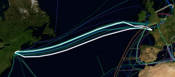
Via Richard Forno, of Infowarrior, this interactive map of the world's undersea data-cable architecture. You can zoom the map in and out and click on any individual cable to see its routes and landing points and other technical info. Eg the trans-Atlantic cable highlighted in white, known as FA-1, has two landings on the U.S. East Coast (on the north and south sides of Long Island) and one each in England and France. Click for larger.
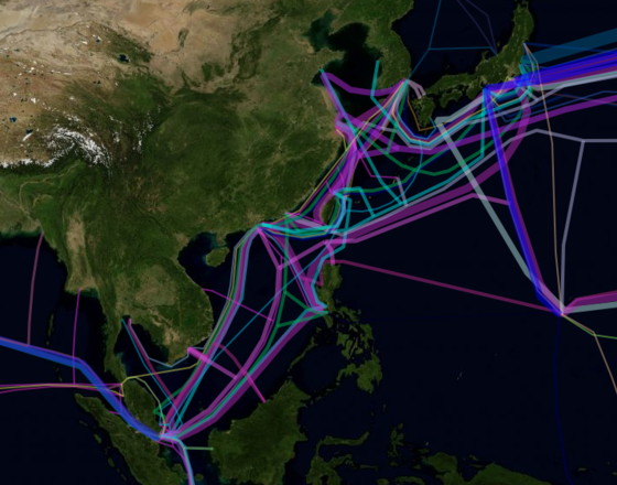
And the map below shows the info-architecture of northern East Asia. If you zoom in close enough, you'll see confirmation of a theme in this article, about the few choke points where internet traffic comes into China (and therefore can easily be controlled).
Forno says (quoting the site's "about" section):
Greg's Cable Map is an attempt to consolidate all the available information about the undersea communications infrastructure. The initial data was harvested from Wikipedia, and further information was gathered by simply googling and transcribing as much data as possible into a useful format, namely a rich geocoded format. I hope you find the resource useful and any constructive criticism is welcome.
The data is available in ArcGIS .shp file format on request, so long as it's not going to be used for profit.
UPDATE: Thanks to reader Joseph K for this link to Neal Stephenson's nearly-15-year-old article about building the undersea infrastructure in Wired, here.